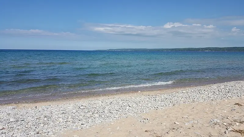
The DNR calls the park a popular stop for beachgoers and Petoskey stone hunters,1 and its management plan says Petoskey stones can be found here in abundance.2
Rules: State park land (DNR). The state limit applies: no more than 25 pounds of rocks, mineral specimens and invertebrate fossils per person per year.3
Fisherman's Island State Park
Charlevoix County
State land (DNR)
Rocks, land and rules
The DNR says the park's rocky, wooded shoreline is popular with Petoskey stone hunters.4
Rules: State park land (DNR). The state limit applies: no more than 25 pounds of rocks, mineral specimens and invertebrate fossils per person per year.3
Wilderness State Park
Emmet County, near Carp Lake and Mackinaw City
State land (DNR)
Rocks, land and rules
Rocks on the Michigan Geological Survey rockhounding map: stromatolite, Jacobsville sandstone, garnet schist, hematite, Lake Superior agate and gastropod.5
Rules: State park land (DNR). The state limit applies: no more than 25 pounds of rocks, mineral specimens and invertebrate fossils per person per year.3
Leelanau State Park
Leelanau County, Northport
State land (DNR)
Rocks, land and rules
The DNR page describes the park's rocky beach.6 The Michigan Geological Survey rockhounding map lists the Grand Traverse Lighthouse here, but marks its rocks as unconfirmed.5
Rules: State park land (DNR). The state limit applies: no more than 25 pounds of rocks, mineral specimens and invertebrate fossils per person per year.3
Keith J. Charters Traverse City State Park
Grand Traverse County, Traverse City
State land (DNR)
Rocks, land and rules
A DNR state park.7 Which rocks turn up here is not yet in our checked sources.
Rules: State park land (DNR). The state limit applies: no more than 25 pounds of rocks, mineral specimens and invertebrate fossils per person per year.3
Local parks (15)
Magnus Park
Emmet County, Petoskey
Local park: City of PetoskeyOfficial, local: City of Petoskey lists "Petoskey Stone Hunting"
Rocks, land and rules
Rocks on the Michigan Geological Survey rockhounding map: Petoskey stone, brachiopod, Charlevoix stone, horn coral and slag.5
The City of Petoskey lists "Petoskey Stone Hunting" as an amenity of the park. Campground fees apply.8
Rules: No rock collecting rule posted by the park; check with the park manager. Managed by the City of Petoskey.8 On the Great Lakes shore below the ordinary high water mark: the same 25 lb limit as on state land, which comes from the DNR rule R 299.922(hh), not from Part 325.3 EGLE describes it as covering state-owned and public trust lands.9
Bayfront Park
Emmet County, Petoskey
Local park: City of Petoskey
Rocks, land and rules
Rocks on the Michigan Geological Survey rockhounding map: Petoskey stone, Charlevoix stone, horn coral, brachiopod and slag.5
The City of Petoskey describes "7800 feet of public shoreline".10
Rules: No rock collecting rule posted by the park; check with the park manager. Managed by the City of Petoskey.10 On the Great Lakes shore below the ordinary high water mark: the same 25 lb limit as on state land, which comes from the DNR rule R 299.922(hh), not from Part 325.3 EGLE describes it as covering state-owned and public trust lands.9
Elk Rapids Day Park
Antrim County, Elk Rapids
Local park: Antrim County
Rocks, land and rules
Rocks on the Michigan Geological Survey rockhounding map: Petoskey stone, "Elk blue" (slag), chert, Charlevoix stone and unakite.5
The parking lot is open May to October; you can walk in all year.11
Rules: No rock collecting rule posted by the park; check with the park manager. Managed by Antrim County.11 On the Great Lakes shore below the ordinary high water mark: the same 25 lb limit as on state land, which comes from the DNR rule R 299.922(hh), not from Part 325.3 EGLE describes it as covering state-owned and public trust lands.9
Antrim Creek Natural Area
Antrim County, near Atwood (Banks Township)
Local park: Antrim CountyProtected plants, follow posted rules
Rocks, land and rules
Rocks on the Michigan Geological Survey rockhounding map: Petoskey stone, horn coral, Charlevoix stone, chain coral and beach glass.5
Antrim County says the area has "federally protected plant species", and signs on site give "rules/directions". Follow the posted signs.12
Rules: No rock collecting rule posted by the park; check with the park manager. Managed by Antrim County.12 On the Great Lakes shore below the ordinary high water mark: the same 25 lb limit as on state land, which comes from the DNR rule R 299.922(hh), not from Part 325.3 EGLE describes it as covering state-owned and public trust lands.9
Van's Beach
Leelanau County, Leland
Local park: Leland Township
Rocks, land and rules
Rocks on the Michigan Geological Survey rockhounding map: Leland blue (slag), unakite, granite, chert, Petoskey stone, Charlevoix stone, horn coral and chain coral, among others.5 More on Leland Blue.
Leland Township's recreation plan lists "Ownership/Management: Leland Township".13 Township beaches are closed from one hour past sunset until sunrise, and the ordinance says "Township property shall not be damaged or destroyed."14
Rules: No rock collecting rule posted by the park; check with the park manager. Managed by Leland Township.13 On the Great Lakes shore below the ordinary high water mark: the same 25 lb limit as on state land, which comes from the DNR rule R 299.922(hh), not from Part 325.3 EGLE describes it as covering state-owned and public trust lands.9
Peterson Park
Leelanau County, Northport
Local park: Leelanau Township
Rocks, land and rules
Rocks on the Michigan Geological Survey rockhounding map: Petoskey stone, chert, unakite and Charlevoix stone.5
Rules: No rock collecting rule posted by the park; check with the park manager. Managed by Leelanau Township.15 On the Great Lakes shore below the ordinary high water mark: the same 25 lb limit as on state land, which comes from the DNR rule R 299.922(hh), not from Part 325.3 EGLE describes it as covering state-owned and public trust lands.9
Christmas Cove Park
Leelanau County, Northport
Local park: Leelanau Township
Rocks, land and rules
Rocks on the Michigan Geological Survey rockhounding map: Petoskey stone, stromatoporoid, Charlevoix stone and fossils.5
Rules: No rock collecting rule posted by the park; check with the park manager. Managed by Leelanau Township.15 On the Great Lakes shore below the ordinary high water mark: the same 25 lb limit as on state land, which comes from the DNR rule R 299.922(hh), not from Part 325.3 EGLE describes it as covering state-owned and public trust lands.9
Omena Beach
Leelanau County, Omena
Local park: Leelanau Township
Rocks, land and rules
About 100 feet of beach frontage.15 Which rocks turn up here is not yet in our checked sources.
Rules: No rock collecting rule posted by the park; check with the park manager. Managed by Leelanau Township.15 On the Great Lakes shore below the ordinary high water mark: the same 25 lb limit as on state land, which comes from the DNR rule R 299.922(hh), not from Part 325.3 EGLE describes it as covering state-owned and public trust lands.9
Reynolds Street beach (access site)
Leelanau County, Leland
Maintained by Leland Township
Rocks, land and rules
Rocks on the Michigan Geological Survey rockhounding map: Leland blue (slag), unakite, granite, chert, banded chert, Petoskey stone, quartz, jasper, Charlevoix stone, horn coral, chain coral, Yooperlite, cold-water agate, Mary Ellen jasper and Lake Superior agate.5 More on Leland Blue.
Leland Township says it "maintains numerous parks and water access sites", open daily "from sunrise until one hour past sunset", and lists this one among its Lake Michigan access sites.16 The township ordinance says "Township property shall not be damaged or destroyed."14
Rules: No rock collecting rule posted by the park; check with the park manager. Maintained by Leland Township.16 On the Great Lakes shore below the ordinary high water mark: the same 25 lb limit as on state land, which comes from the DNR rule R 299.922(hh), not from Part 325.3 EGLE describes it as covering state-owned and public trust lands.9
North Street beach (access site)
Leelanau County, Leland
Maintained by Leland Township
Rocks, land and rules
Rocks on the Michigan Geological Survey rockhounding map: Petoskey stone, stromatoporoid, horn coral, granite, unakite, Charlevoix stone, stromatolite, quartz, Mary Ellen jasper, Lake Superior agate, Leland blue (slag), hematite, cold-water agate and Yooperlite.5 More on Leland Blue.
Leland Township says it "maintains numerous parks and water access sites", open daily "from sunrise until one hour past sunset", and lists this one among its Lake Michigan access sites.16 The township ordinance says "Township property shall not be damaged or destroyed."14
Rules: No rock collecting rule posted by the park; check with the park manager. Maintained by Leland Township.16 On the Great Lakes shore below the ordinary high water mark: the same 25 lb limit as on state land, which comes from the DNR rule R 299.922(hh), not from Part 325.3 EGLE describes it as covering state-owned and public trust lands.9
Headlands International Dark Sky Park
Emmet County, Mackinaw City
Local park: Emmet County
Rocks, land and rules
Open 24 hours a day, but "camping is not permitted". Pets must be on a six-foot leash, and no white lights in the viewing area.17 No rock list from an official source yet.
Rules: No rock collecting rule posted by the park; check with the park manager. Managed by Emmet County.17 On the Great Lakes shore below the ordinary high water mark: the same 25 lb limit as on state land, which comes from the DNR rule R 299.922(hh), not from Part 325.3 EGLE describes it as covering state-owned and public trust lands.9
Zorn Park Beach
Emmet County, Harbor Springs
Local park: City of Harbor Springs
Rocks, land and rules
The city says: "Please pay close attention to rule signs posted at the Zorn Park Beach". Lifeguards are on duty until 6 pm in summer.18 No rock list from an official source yet.
Rules: No rock collecting rule posted by the park; check with the park manager. Managed by the City of Harbor Springs.18 On the Great Lakes shore below the ordinary high water mark: the same 25 lb limit as on state land, which comes from the DNR rule R 299.922(hh), not from Part 325.3 EGLE describes it as covering state-owned and public trust lands.9
Mt. McSauba Recreation Area
Charlevoix County, Charlevoix
Local park: City of Charlevoix
Rocks, land and rules
The City of Charlevoix says the area is "owned by the City, but located within Charlevoix Township", with "extensive beach frontage on Lake Michigan".19 No rock list from an official source yet.
Rules: No rock collecting rule posted by the park; check with the park manager. Managed by the City of Charlevoix.19 On the Great Lakes shore below the ordinary high water mark: the same 25 lb limit as on state land, which comes from the DNR rule R 299.922(hh), not from Part 325.3 EGLE describes it as covering state-owned and public trust lands.9
Haserot Beach
Grand Traverse County, Old Mission
Local park: Peninsula TownshipNo digging (Ordinance 57)
Rocks, land and rules
Peninsula Township: "The only improved public beach access on the Old Mission Peninsula".20 No rock list from an official source yet.
No digging. Peninsula Township Ordinance No. 57 of 2023 says "earth moving ... not permitted" and "Township property shall not be damaged or destroyed". No one may be in a park "earlier than one hour before sunrise or later than one hour after sundown".21
Rules: No rock collecting rule posted by the park; check with the park manager. Managed by Peninsula Township.20 On the Great Lakes shore below the ordinary high water mark: the same 25 lb limit as on state land, which comes from the DNR rule R 299.922(hh), not from Part 325.3 EGLE describes it as covering state-owned and public trust lands.9
Veterans Memorial Park beach
Antrim County, Elk Rapids
Local park: Village of Elk Rapids
Rocks, land and rules
The village says: "Memorial park features a modest beach on the Grand Traverse Bay".22 No rock list from an official source yet.
Rules: No rock collecting rule posted by the park; check with the park manager. Managed by the Village of Elk Rapids.22 On the Great Lakes shore below the ordinary high water mark: the same 25 lb limit as on state land, which comes from the DNR rule R 299.922(hh), not from Part 325.3 EGLE describes it as covering state-owned and public trust lands.9
Good to know
Petoskey stones are most common on northern beaches, though they also turn up farther south.23
They come from the Devonian reef limestones of the Gravel Point Formation, which occur in Charlevoix, Emmet, Cheboygan, Presque Isle and Alpena counties.24
Charlevoix stone is the local nickname for Favosites, a tabulate coral with closely packed, honeycomb-like cells.2325
Not allowed
Sleeping Bear Dunes National Lakeshore: "it is illegal under federal law to remove stones from the National Lakeshore."26