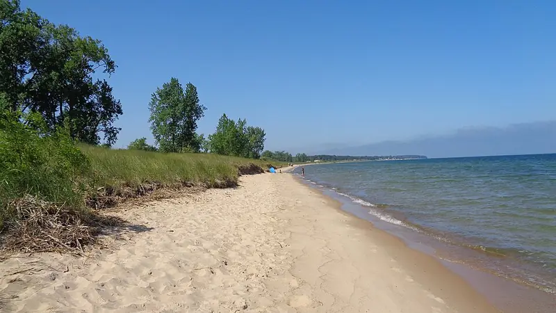
The DNR describes "a little over a mile of rocky Lake Huron shoreline".1 Rocks on the Michigan Geological Survey rockhounding map: puddingstone, fossils and Petoskey stone.2
Rules: State park land (DNR). The state limit applies: no more than 25 pounds of rocks, mineral specimens and invertebrate fossils per person per year.3
Port Crescent State Park
Huron County, Port Austin
State land (DNR)
Rocks, land and rules
The Michigan Geological Survey rockhounding map lists this spot, but marks its rocks as unconfirmed.2
Rules: State park land (DNR). The state limit applies: no more than 25 pounds of rocks, mineral specimens and invertebrate fossils per person per year.3
Albert E. Sleeper State Park
Huron County, Caseville
State land (DNR)
Rocks, land and rules
The Michigan Geological Survey rockhounding map lists this spot, but marks its rocks as unconfirmed.2
Rules: State park land (DNR). The state limit applies: no more than 25 pounds of rocks, mineral specimens and invertebrate fossils per person per year.3
Bay City State Park
Bay County, Bay City
State land (DNR)
Rocks, land and rules
Rocks on the Michigan Geological Survey rockhounding map: chert, jasper, limestone, brachiopod, chain coral, crinoid and "fossil soup".2
Rules: State park land (DNR). The state limit applies: no more than 25 pounds of rocks, mineral specimens and invertebrate fossils per person per year.3
Local parks (3)
Lakeside Beach (Lakeside Park)
St. Clair County, Port Huron
Local park: City of Port Huron
Rocks, land and rules
Rocks on the Michigan Geological Survey rockhounding map: puddingstone, unakite and cold-water agate, plus Petoskey stone marked as uncertain.2
Paid parking runs from the Thursday before Memorial Day to Labor Day; city residents park free, and the rates are on the city page. "Pets are not allowed on the beach."4
Rules: No rock collecting rule posted by the park; check with the park manager. Managed by the City of Port Huron.4 On the Great Lakes shore below the ordinary high water mark: the same 25 lb limit as on state land, which comes from the DNR rule R 299.922(hh), not from Part 325.3 EGLE describes it as covering state-owned and public trust lands.5
Lighthouse Beach
St. Clair County, Port Huron
Local park: City of Port Huron
Rocks, land and rules
The Michigan Geological Survey rockhounding map lists this spot, but marks its rocks as unconfirmed.2
Paid parking runs from the Thursday before Memorial Day to Labor Day, with weekend parking attendants; city residents park free.4
Rules: No rock collecting rule posted by the park; check with the park manager. Managed by the City of Port Huron.4 On the Great Lakes shore below the ordinary high water mark: the same 25 lb limit as on state land, which comes from the DNR rule R 299.922(hh), not from Part 325.3 EGLE describes it as covering state-owned and public trust lands.5
Bird Creek Park (Port Austin beach)
Huron County, Port Austin
Local park: Huron County Parks
Rocks, land and rules
Huron County: "Bird Creek features a 350-foot boardwalk along its one-acre beach", in the Village of Port Austin.6 No rock list from an official source yet.
County rules: "Possession of alcoholic beverages is prohibited on any Huron County Park Beach" and "All glass containers are prohibited on any beach".7
Rules: No rock collecting rule posted by the park; check with the park manager. Managed by Huron County Parks.6 On the Great Lakes shore below the ordinary high water mark: the same 25 lb limit as on state land, which comes from the DNR rule R 299.922(hh), not from Part 325.3 EGLE describes it as covering state-owned and public trust lands.5
Beaches named by EGLE (1)
Fort Gratiot County Park
St. Clair County
Owner not confirmed
Rocks, land and rules
EGLE names Fort Gratiot County Park as a known Petoskey stone collecting locality.8
Rules: Who owns this beach, and any local rules, have not been confirmed. Check posted signs and ask the land manager before you collect.
Good to know
Petoskey stones are most common up north, but glaciers spread them widely, and they turn up this far south too.89
Not allowed
Sanilac Petroglyphs Historic State Park: a DNR order prohibits people to "Walk upon or otherwise come into contact with the petroglyph rock within the fenced area."10