Where to hunt
Where to hunt, by region
Every spot here is named by an official source: a DNR park page, EGLE, or the local government that manages the park.
How to use this map
Tap a pin for a park's rocks and rules, or a region for its geology story. 76 spots in 7 regions; the region lines are approximate county groupings made for this site.
Rock hunting map
57 spots on the map. Tap a pin for its rocks and rules, pick a rock to light up where it is listed, or tap a region for its geology story.
- State land, 25 lb limit
- Local park, local rules
- No collecting
- Owner not confirmed
- Archean
- Early Proterozoic
- Middle Proterozoic
- Cambrian
- Ordovician
- Silurian
- Devonian
- Mississippian
- Pennsylvanian
- RED BEDS (name from the state bedrock map; age not given)
Pins are approximate; check the land manager's map before you go.
F.J. McLain State Park
State land (DNR)25 lb per year on state land
Land: State land, managed by the Michigan DNR
Rocks you can find
No rock list from an official source yet.
Pin source: P1
Eagle River beach
Owner not confirmed
Land: Owner not confirmed in our checked sources
Rocks you can find
Rock list: named in the official text for this spot.2
Pin source: P2
Agate Beach, Toivola
Owner not confirmed
Land: Owner not confirmed in our checked sources
Rocks you can find
Rock list: named in the official text for this spot.2
Pin source: P3
Little Girl's Point County Park
Local park: Gogebic County
Land: Local park (Gogebic County)
Rocks you can find
Rock list: Michigan Geological Survey rockhounding map.1
Pin source: P4
Porcupine Mountains Wilderness State Park (Union Bay shoreline)
State land (DNR)25 lb per year on state land
Land: State land, managed by the Michigan DNR
Rocks you can find
No rock list from an official source yet.
Pin source: P5
Baraga State Park
State land (DNR)25 lb per year on state land
Land: State land, managed by the Michigan DNR
Rocks you can find
No rock list from an official source yet.
Pin source: P6
Bete de Gris Beach
Maintained by Keweenaw County Road Commission
Land: Local park (Keweenaw County Road Commission)
Rocks you can find
No rock list from an official source yet.
Pin source: P7
Green Park
Local park: Carp Lake Township
Land: Local park (Carp Lake Township)
Rocks you can find
Rock list: Michigan Geological Survey rockhounding map.1
Pin source: P8
Grand Marais public beach
Owner not confirmed
Land: Owner not confirmed in our checked sources
Rocks you can find
Rock list: named in the official text for this spot.2
Pin source: P9
J.W. Wells State Park
State land (DNR)25 lb per year on state land
Land: State land, managed by the Michigan DNR
Rocks you can find
No rock list from an official source yet.
Pin source: P10
Picnic Rocks waterfront
Local park: City of Marquette
Land: Local park (City of Marquette)
Rocks you can find
No rock list from an official source yet.
Pin source: P11
Middle Beach at Presque Isle Park
Local park: City of Marquette
Land: Local park (City of Marquette)
Rocks you can find
No rock list from an official source yet.
Pin source: P12
Little Presque Isle
State land (DNR)25 lb per year on state landNominated natural area; follow posted rules
Land: State land, managed by the Michigan DNR
Rocks you can find
No rock list from an official source yet.
Pin source: P13
Muskallonge Lake State Park
State land (DNR)25 lb per year on state land
Land: State land, managed by the Michigan DNR
Rocks you can find
Rock list: named in the official text for this spot.3
Pin source: P14
Brimley State Park
State land (DNR)25 lb per year on state land
Land: State land, managed by the Michigan DNR
Rocks you can find
No rock list from an official source yet.
Pin source: P15
Tahquamenon Falls State Park, Rivermouth unit
State land (DNR)25 lb per year on state land
Land: State land, managed by the Michigan DNR
Rocks you can find
No rock list from an official source yet.
Pin source: P16
Straits State Park
State land (DNR)25 lb per year on state land
Land: State land, managed by the Michigan DNR
Rocks you can find
No rock list from an official source yet.
Pin source: P17
Mouth of Two Hearted River State Forest Campground
State land (DNR)25 lb per year on state land
Land: State land, managed by the Michigan DNR
Rocks you can find
- Unakite
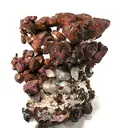 Chert
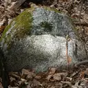 Granite
- Quartz
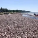 Rhyolite
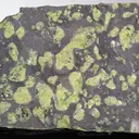 Amygdaloidal basalt
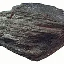 Hematite
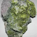 Epidote
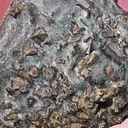 Gneiss
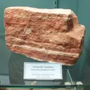 Jacobsville sandstone
- Chalcedony
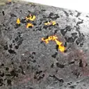 Yooperlite
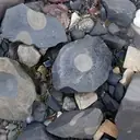 Omar
- Mary Ellen jasper
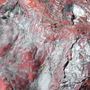 Jaspilite
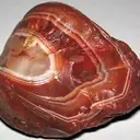 Lake Superior agate
- Jasper
- Banded iron formation
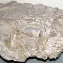 Kona dolomite
Rock list: Michigan Geological Survey rockhounding map.1
Pin source: P18
Petoskey State Park
State land (DNR)25 lb per year on state land
Land: State land, managed by the Michigan DNR
Rocks you can find
Rock list: named in the official text for this spot.4
Pin source: P19
Fisherman's Island State Park
State land (DNR)25 lb per year on state land
Land: State land, managed by the Michigan DNR
Rocks you can find
Rock list: named in the official text for this spot.5
Pin source: P20
Wilderness State Park
State land (DNR)25 lb per year on state land
Land: State land, managed by the Michigan DNR
Rocks you can find
Rock list: Michigan Geological Survey rockhounding map.1
Pin source: P21
Leelanau State Park
State land (DNR)25 lb per year on state land
Land: State land, managed by the Michigan DNR
Rocks you can find
No rock list from an official source yet.
Pin source: P22
Keith J. Charters Traverse City State Park
State land (DNR)25 lb per year on state land
Land: State land, managed by the Michigan DNR
Rocks you can find
No rock list from an official source yet.
Pin source: P23
Bayfront Park
Local park: City of Petoskey
Land: Local park (City of Petoskey)
Rocks you can find
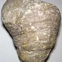
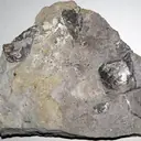
Rock list: Michigan Geological Survey rockhounding map.1
Pin source: P24
Antrim Creek Natural Area
Local park: Antrim CountyProtected plants, follow posted rules
Land: Local park (Antrim County)
Rocks you can find
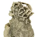
Rock list: Michigan Geological Survey rockhounding map.1
Pin source: P25
Christmas Cove Park
Local park: Leelanau Township
Land: Local park (Leelanau Township)
Rocks you can find
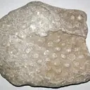
Rock list: Michigan Geological Survey rockhounding map.1
Pin source: P26
Omena Beach
Local park: Leelanau Township
Land: Local park (Leelanau Township)
Rocks you can find
No rock list from an official source yet.
Pin source: P27
Headlands International Dark Sky Park
Local park: Emmet County
Land: Local park (Emmet County)
Rocks you can find
No rock list from an official source yet.
Pin source: P28
Mt. McSauba Recreation Area
Local park: City of Charlevoix
Land: Local park (City of Charlevoix)
Rocks you can find
No rock list from an official source yet.
Pin source: P29
Haserot Beach
Local park: Peninsula TownshipNo digging (Ordinance 57)
Land: Local park (Peninsula Township)
Rocks you can find
No rock list from an official source yet.
Pin source: P30
Rockport State Recreation Area
State land (DNR)25 lb per year on state land
Land: State land, managed by the Michigan DNR
Rocks you can find
- Fossils
Rock list: named in the official text for this spot.6
Pin source: P31
P.H. Hoeft State Park
State land (DNR)25 lb per year on state land
Land: State land, managed by the Michigan DNR
Rocks you can find
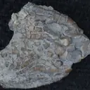
Rock list: Michigan Geological Survey rockhounding map.1
Pin source: P32
Thompson's Harbor State Park
State land (DNR)25 lb per year on state land
Land: State land, managed by the Michigan DNR
Rocks you can find
Rock list: Michigan Geological Survey rockhounding map.1
Pin source: P33
Negwegon State Park
State land (DNR)25 lb per year on state land
Land: State land, managed by the Michigan DNR
Rocks you can find
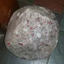 Puddingstone
- Granite
- Quartz
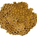 Charlevoix stone
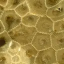 Petoskey stone
- Gneiss
- Gowganda tillite
Rock list: Michigan Geological Survey rockhounding map.1
Pin source: P34
Harrisville State Park
State land (DNR)25 lb per year on state land
Land: State land, managed by the Michigan DNR
Rocks you can find
Rock list: Michigan Geological Survey rockhounding map.1
Pin source: P35
Tawas Point State Park
State land (DNR)25 lb per year on state land
Land: State land, managed by the Michigan DNR
Rocks you can find
Rock list: Michigan Geological Survey rockhounding map.1
Pin source: P36
Cheboygan State Park
State land (DNR)25 lb per year on state land
Land: State land, managed by the Michigan DNR
Rocks you can find
No rock list from an official source yet.
Pin source: P37
Onaway State Park
State land (DNR)25 lb per year on state land
Land: State land, managed by the Michigan DNR
Rocks you can find
- Fossils
Rock list: Michigan Geological Survey rockhounding map.1
Pin source: P38
Sturgeon Point State Park
State land (DNR)25 lb per year on state land
Land: State land, managed by the Michigan DNR
Rocks you can find
Rock list: Michigan Geological Survey rockhounding map.1
Pin source: P39
Partridge Point public access site
State land (DNR)25 lb per year on state land
Land: State land, managed by the Michigan DNR
Rocks you can find
Rock list: Michigan Geological Survey rockhounding map.1
Pin source: P40
Fort Gratiot County Park
Owner not confirmed
Land: Owner not confirmed in our checked sources
Rocks you can find
Rock list: named in the official text for this spot.7
Pin source: P41
Lakeport State Park
State land (DNR)25 lb per year on state land
Land: State land, managed by the Michigan DNR
Rocks you can find
- Puddingstone
- Fossils
- Petoskey stone
Rock list: Michigan Geological Survey rockhounding map.1
Pin source: P42
Port Crescent State Park
State land (DNR)25 lb per year on state land
Land: State land, managed by the Michigan DNR
Rocks you can find
No rock list from an official source yet.
Pin source: P43
Albert E. Sleeper State Park
State land (DNR)25 lb per year on state land
Land: State land, managed by the Michigan DNR
Rocks you can find
No rock list from an official source yet.
Pin source: P44
Bay City State Park
State land (DNR)25 lb per year on state land
Land: State land, managed by the Michigan DNR
Rocks you can find
Rock list: Michigan Geological Survey rockhounding map.1
Pin source: P45
Lighthouse Beach
Local park: City of Port Huron
Land: Local park (City of Port Huron)
Rocks you can find
No rock list from an official source yet.
Pin source: P46
Bird Creek Park (Port Austin beach)
Local park: Huron County Parks
Land: Local park (Huron County Parks)
Rocks you can find
No rock list from an official source yet.
Pin source: P47
Frankfort public beach
Owner not confirmed
Land: Owner not confirmed in our checked sources
Rocks you can find
Rock list: named in the official text for this spot.7
Pin source: P48
Orchard Beach State Park
State land (DNR)25 lb per year on state land
Land: State land, managed by the Michigan DNR
Rocks you can find
No rock list from an official source yet.
Pin source: P49
Ludington State Park
State land (DNR)25 lb per year on state land
Land: State land, managed by the Michigan DNR
Rocks you can find
No rock list from an official source yet.
Pin source: P50
Charles Mears State Park
State land (DNR)25 lb per year on state land
Land: State land, managed by the Michigan DNR
Rocks you can find
No rock list from an official source yet.
Pin source: P51
Duck Lake State Park
State land (DNR)25 lb per year on state land
Land: State land, managed by the Michigan DNR
Rocks you can find
No rock list from an official source yet.
Pin source: P52
Muskegon State Park
State land (DNR)25 lb per year on state land
Land: State land, managed by the Michigan DNR
Rocks you can find
No rock list from an official source yet.
Pin source: P53
Van Buren State Park
State land (DNR)25 lb per year on state land
Land: State land, managed by the Michigan DNR
Rocks you can find
Rock list: Michigan Geological Survey rockhounding map.1
Pin source: P54
Deerlick Creek Park
Local park: South Haven Charter Township
Land: Local park (South Haven Charter Township)
Rocks you can find
- Petoskey stone
- Fossils
- Septarian nodules (<a href="@P@rocks/index
Rock list: Michigan Geological Survey rockhounding map.1
Pin source: P55
Grand Mere State Park
State land (DNR)25 lb per year on state land
Land: State land, managed by the Michigan DNR
Rocks you can find
No rock list from an official source yet.
Pin source: P56
Summit Township Park
Local park: Summit Township
Land: Local park (Summit Township)
Rocks you can find
No rock list from an official source yet.
Pin source: P57
Quartz, amethyst, jasper and chert: listed at 27 spots, 18 of them on the map. Age: Not yet in our checked sources. Rock card
Petoskey stone: listed at 20 spots, 13 of them on the map. Age: "Middle Devonian (393 - 382 million years ago)." Rock card
Lake Superior agate: listed at 12 spots, 8 of them on the map. Age: Formed inside the Midcontinent Rift lavas, which erupted about 1,109 to 1,087 million years ago. Rock card
Charlevoix stone (Favosites): listed at 11 spots, 5 of them on the map. Age: Favosites "lived from the Ordovician to the Permian (450-251 million years ago)." The Michigan specimens U-M shows are "Middle Devonian (393 - 382 million years ago)." Rock card
Granite and other glacial erratics: listed at 11 spots, 8 of them on the map. Age: Not yet in our checked sources. Rock card
Horn corals: listed at 9 spots, 5 of them on the map. Age: "In Michigan, horn corals can be found in rocks ranging from the Ordovician to Mississippian (485 - 323 million years ago)." Rock card
Puddingstone: listed at 7 spots, 6 of them on the map. Age: The Lorrain Formation jasper conglomerate "is 2,200 - 2,450 million years old ... part of the Huronian supergroup." Rock card
Brachiopods: listed at 6 spots, 5 of them on the map. Age: U-M: in Michigan, brachiopods are found in rocks "ranging from the Ordovician to Mississippian" (485 to 323 million years ago). Rock card
Yooperlite® (sodalite syenite): listed at 6 spots, 3 of them on the map. Age: Not yet in our checked sources. Rock card
Gneiss, schist, slate and quartzite: listed at 5 spots, 5 of them on the map. Age: Precambrian (EGLE). Rock card
Pipe and chain corals: listed at 5 spots, 3 of them on the map. Age: Not yet in our checked sources. Rock card
Crinoids (sea lilies): listed at 4 spots, 4 of them on the map. Age: U-M: in Michigan, crinoid material is found in rocks "ranging from the Ordovician to Mississippian" (485 to 323 million years ago), and is "commonly found in Middle Devonian" rocks (393 to 382 million years ago). Rock card
Hematite and specularite: listed at 3 spots, 2 of them on the map. Age: The iron formations formed about 1.9 billion years ago (USGS). Rock card
Leland Blue (slag glass): listed at 3 spots, 0 of them on the map. Age: Man-made, so it has no geologic age. It dates from Leland's iron-furnace years. The ironworks were built in 1870 (NPS; some local histories say 1872), and the Leland Lake Superior Iron Company and the firms that followed it ran the furnace until 1884 (NPS); the historical society lists a last firm from 1885. Rock card
Limestone and dolomite (dolostone): listed at 3 spots, 3 of them on the map. Age: EGLE lists limestone and dolomite among Michigan's Devonian and Mississippian rocks, and limestone among its Pennsylvanian rocks. Rock card
Sandstone and Jacobsville Sandstone: listed at 3 spots, 3 of them on the map. Age: The Jacobsville is Precambrian, "the youngest of the area's Precambrian rocks, but the exact age is unknown." It is older than about 542 million years. EGLE lists sandstone among Michigan's Cambrian, Mississippian and Pennsylvanian rocks too. Rock card
Basalt and amygdaloid: listed at 2 spots, 2 of them on the map. Age: The rift lavas erupted about 1,109 to 1,087 million years ago (USGS). Rock card
Jaspilite (banded iron formation): listed at 2 spots, 2 of them on the map. Age: The iron formations formed about 1.9 billion years ago (USGS). Rock card
Rhyolite: listed at 2 spots, 2 of them on the map. Age: Not yet in our checked sources. Rock card
Stromatoporoids (sponges): listed at 2 spots, 1 of them on the map. Age: "most commonly found in Devonian rock (about 390 million years ago)." Rock card
Blastoids: listed at 1 spot, 1 of them on the map. Age: U-M: the Michigan blastoid Placoblastus obovatus is found in Middle Devonian rocks (393 to 382 million years ago). Rock card
Chlorastrolite (greenstone): listed at 1 spot, 0 of them on the map. Age: Formed in the Keweenaw lava flows of the Midcontinent Rift, which erupted about 1,109 to 1,087 million years ago. Rock card
Epidote: listed at 1 spot, 1 of them on the map. Age: Not yet in our checked sources. Rock card
Fossil snails (gastropods): listed at 1 spot, 1 of them on the map. Age: U-M: in Michigan, sea snails are found in rocks "ranging from the Ordovician to Mississippian" (485 to 323 million years ago). Rock card
Native copper and float copper: listed at 1 spot, 0 of them on the map. Age: USGS dates the Keweenaw native copper to between 1,060 and 1,047 million years ago. Rock card
Omars: listed at 1 spot, 1 of them on the map. Age: Not yet in our checked sources. Rock card
Prehnite and patricianite: listed at 1 spot, 0 of them on the map. Age: Not yet in our checked sources. Rock card
Keweenaw and western Upper Peninsula
Copper country: ancient lava flows, old mines and Lake Superior beaches.
Bedrock here: Middle Proterozoic about 53%, Early Proterozoic about 37%, Archean about 10%.910
Native copper is found along a narrow belt more than 150 kilometers long that runs southwest through Keweenaw, Houghton and Ontonagon counties.8
Central Upper Peninsula
Long Lake Superior beaches and the sandstone cliffs of the Pictured Rocks area.
Bedrock here: Ordovician about 53%, Archean about 17%, Cambrian about 9%.910
Lake Superior agates turn up all along the Upper Peninsula's Lake Superior shoreline. Look for a beach with lots of exposed pebbles, ideally after a storm.2
Eastern Upper Peninsula
Quiet Lake Superior shoreline east of Grand Marais.
Bedrock here: Ordovician about 45%, Silurian about 41%, Middle Proterozoic about 11%.910
Lake Superior agates turn up all along the Upper Peninsula's Lake Superior shoreline. Look for a beach with lots of exposed pebbles, ideally after a storm.2
Northwest Lower Peninsula
Grand Traverse Bay and Little Traverse Bay: the classic Petoskey stone coast.
Bedrock here: Devonian about 49%, Mississippian about 41%, Pennsylvanian about 11%.910
Petoskey stones are most common on northern beaches, though they also turn up farther south.7
Northeast Lower Peninsula and Lake Huron
Lake Huron shoreline and old limestone quarries.
Bedrock here: Mississippian about 48%, Devonian about 33%, Pennsylvanian about 15%.910
Corals are among the most common fossils on Michigan beaches.7
Thumb and Southeast
Saginaw Bay, the Thumb and the Lake Huron shore down to Port Huron.
Bedrock here: Mississippian about 50%, Pennsylvanian about 29%, Devonian about 14%.910
Petoskey stones are most common up north, but glaciers spread them widely, and they turn up this far south too.711
Lower Peninsula west shore
The Lake Michigan shore from Frankfort south.
Bedrock here: Mississippian about 58%, Pennsylvanian about 18%, RED BEDS (name from the state bedrock map; age not given) about 14%.910
Petoskey stones also turn up south of the northern beaches, and inland in many sand and gravel mines across the state.7
Spots without a pin (19)
No authoritative source gives a location for these, so they are on their region pages but not on the map.
- Calumet Township Waterworks Park: The township page gives only its office addresses, with no park address or map point.
- Hunter's Point Park: Grant Township's park page and ordinance give no address or map point.
- Pebble Beach, Marquette: Named only in state agency text; no land manager page gives its location.
- McCarty's Cove (including North McCarty's Cove): The Marquette Fire Department beach page lists the name only, with no address or map point.
- South Beach: The Marquette Fire Department beach page lists the name only, with no address or map point.
- Clark Lambros' Beach Park: The DNR news release names the park but gives no address or map point.
- Lakeview Park: The city page says only "Along US Hwy 2", with no street address or map point.
- Ludington Park and Municipal Beach (Aronson Island): The Escanaba parks page gives no address or map point.
- Magnus Park: The city page links to a map search, not to a fixed point, and gives no park street address.
- Elk Rapids Day Park: The Antrim County page gives only the county office address.
- Van's Beach: The Leland Township plan and ordinance name it but give no address or map point.
- Peterson Park: Leelanau Township gives 10001 E. Peterson Park Rd., but the US Census Bureau geocoder finds no match for that address.
- Reynolds Street beach (access site): A street-end access site; the township page gives no address or map point.
- North Street beach (access site): A street-end access site; the township page gives no address or map point.
- Zorn Park Beach: The city page says only "on Bay Street just West of the Central Business District", with no street number or map point.
- Veterans Memorial Park beach: The village page gives no address or map point.
- Mich-e-ke-wis Park: The city page gives only the city hall address.
- Lakeside Beach (Lakeside Park): The Port Huron page names the beach but, unlike Lighthouse Beach, gives no address.
- Rocky Gap County Park: The Berrien County park page gives no address or map point.
Where the pins come from
Each pin is a point from an official source: the facility points a Michigan DNR park page maps, a USGS GNIS feature point, a map link on the land manager's page, or a US Census Bureau geocoder match of the address the land manager publishes.
- P1: https://www.michigan.gov/recsearch/parks/mclain
- P2: https://edits.nationalmap.gov/apps/gaz-domestic/public/summary/625096
- P3: https://edits.nationalmap.gov/apps/gaz-domestic/public/summary/619862
- P4: https://www.gogebicforestryandparks.com/littlegirlspoint
- P5: https://www.michigan.gov/recsearch/parks/porkies
- P6: https://www.michigan.gov/recsearch/parks/baraga
- P7: https://edits.nationalmap.gov/apps/gaz-domestic/public/summary/621196
- P8: https://www.carplaketwp.org/general-resources
- P9: https://edits.nationalmap.gov/apps/gaz-domestic/public/summary/627096
- P10: https://www.michigan.gov/recsearch/parks/jwwells
- P11: https://edits.nationalmap.gov/apps/gaz-domestic/public/summary/634819
- P12: https://edits.nationalmap.gov/apps/gaz-domestic/public/summary/635429
- P13: https://www.michigan.gov/recsearch/parks/littlepresque
- P14: https://www.michigan.gov/recsearch/parks/muskallonge
- P15: https://www.michigan.gov/recsearch/parks/brimley
- P16: https://www.michigan.gov/recsearch/parks/tahquamenonfalls
- P17: https://www.michigan.gov/recsearch/parks/straits
- P18: https://www.michigan.gov/recsearch/sfcampgroundsa-m/mouthoftwoheartedriver
- P19: https://www.michigan.gov/recsearch/parks/petoskey
- P20: https://www.michigan.gov/recsearch/parks/fishermans
- P21: https://www.michigan.gov/recsearch/parks/wilderness
- P22: https://www.michigan.gov/recsearch/parks/leelanau
- P23: https://www.michigan.gov/recsearch/parks/traversecity
- P24: https://www.petoskey.us/services/parks___recreation/parks/bayfront_park.php
- P25: https://edits.nationalmap.gov/apps/gaz-domestic/public/summary/620157
- P26: https://edits.nationalmap.gov/apps/gaz-domestic/public/summary/1617287
- P27: https://edits.nationalmap.gov/apps/gaz-domestic/public/summary/634055
- P28: https://www.emmetcounty.org/experiences/headlands/
- P29: https://edits.nationalmap.gov/apps/gaz-domestic/public/summary/632027
- P30: https://www.peninsulatownship.com/parks.html
- P31: https://www.michigan.gov/recsearch/parks/rockport
- P32: https://www.michigan.gov/recsearch/parks/hoeft
- P33: https://www.michigan.gov/recsearch/parks/thompsonsharbor
- P34: https://www.michigan.gov/recsearch/parks/negwegon
- P35: https://www.michigan.gov/recsearch/parks/harrisville
- P36: https://www.michigan.gov/recsearch/parks/tawaspoint
- P37: https://www.michigan.gov/recsearch/parks/cheboygan
- P38: https://www.michigan.gov/recsearch/parks/onaway
- P39: https://www.michigan.gov/recsearch/parks/sturgeonpoint
- P40: https://edits.nationalmap.gov/apps/gaz-domestic/public/summary/634442
- P41: https://www.stclaircounty.org/offices/parks/fort_gratiot.aspx
- P42: https://www.michigan.gov/recsearch/parks/lakeport
- P43: https://www.michigan.gov/recsearch/parks/portcrescent
- P44: https://www.michigan.gov/recsearch/parks/sleeper
- P45: https://www.michigan.gov/recsearch/parks/baycity
- P46: https://www.porthuron.org/government/departments/parks_and_forestry/city_parks_and_beaches.php
- P47: https://edits.nationalmap.gov/apps/gaz-domestic/public/summary/621430
- P48: https://edits.nationalmap.gov/apps/gaz-domestic/public/summary/626407
- P49: https://www.michigan.gov/recsearch/parks/orchardbeach
- P50: https://www.michigan.gov/recsearch/parks/ludington
- P51: https://www.michigan.gov/recsearch/parks/mears
- P52: https://www.michigan.gov/recsearch/parks/ducklake
- P53: https://www.michigan.gov/recsearch/parks/muskegon
- P54: https://www.michigan.gov/recsearch/parks/vanburen
- P55: https://edits.nationalmap.gov/apps/gaz-domestic/public/summary/624504
- P56: https://www.michigan.gov/recsearch/parks/grandmere
- P57: https://summittownship.org/rentals-attractions/summit-park-pavilion-rental/
Regions
 Keweenaw and western Upper PeninsulaCopper country: ancient lava flows, old mines and Lake Superior beaches.10 spots: F.J. McLain State Park; Eagle River beach; Agate Beach, Toivola; and 7 more
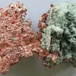 Native copper
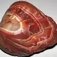 Lake Superior agate
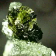 Chlorastrolite
 Central Upper PeninsulaLong Lake Superior beaches and the sandstone cliffs of the Pictured Rocks area.11 spots: Grand Marais public beach; Pebble Beach, Marquette; J.W. Wells State Park; and 8 moreLake Superior agate
 Eastern Upper PeninsulaQuiet Lake Superior shoreline east of Grand Marais.5 spots: Muskallonge Lake State Park; Brimley State Park; Tahquamenon Falls State Park, Rivermouth unit; and 2 moreLake Superior agate
 Northwest Lower PeninsulaGrand Traverse Bay and Little Traverse Bay: the classic Petoskey stone coast.20 spots: Petoskey State Park; Fisherman's Island State Park; Wilderness State Park; and 17 more
 Petoskey stone
 Charlevoix stone
 Northeast Lower Peninsula and Lake HuronLake Huron shoreline and old limestone quarries.11 spots: Rockport State Recreation Area; P.H. Hoeft State Park; Thompson's Harbor State Park; and 8 morePetoskey stone
 Fossil corals
 Thumb and SoutheastSaginaw Bay, the Thumb and the Lake Huron shore down to Port Huron.8 spots: Fort Gratiot County Park; Lakeport State Park; Port Crescent State Park; and 5 morePetoskey stone
 Lower Peninsula west shoreThe Lake Michigan shore from Frankfort south.11 spots: Frankfort public beach; Orchard Beach State Park; Ludington State Park; and 8 morePetoskey stone
Collecting limits for every kind of land: Rules.
Sources (11)
- Michigan Geological Survey (Western Michigan University), Michigan Rockhounding Map, linked from MGS Rockhounds. https://mgs.wmich.edu/education-and-outreach/corekids/mgs-rockhounds/ (checked October 21, 2026)
- Michigan EGLE, Rockhounding. https://www.michigan.gov/egle/public/learn/geology/rockhounding (checked October 21, 2026)
- Michigan DNR, Muskallonge Lake State Park. https://www.michigan.gov/recsearch/parks/muskallonge (checked October 21, 2026)
- Michigan DNR, Petoskey State Park. https://www.michigan.gov/recsearch/parks/petoskey (checked October 21, 2026)
- Michigan DNR, Fisherman's Island State Park. https://www.michigan.gov/recsearch/parks/fishermans (checked October 21, 2026)
- Michigan DNR, Rockport State Recreation Area. https://www.michigan.gov/recsearch/parks/rockport (checked October 21, 2026)
- Michigan EGLE, Fossils. https://www.michigan.gov/egle/public/learn/geology/rockhounding/fossils (checked October 21, 2026)
- A. E. Seaman Mineral Museum (Michigan Tech), Copper (PDF). https://museum.mtu.edu/pdfs/COPPER.pdf (checked October 21, 2026)
- State of Michigan OpenData geology map service, Bedrock Geology layer. https://gisagocss.state.mi.us/arcgis/rest/services/OpenData/geology/MapServer (checked October 21, 2026)
- USGS, State Geologic Map Compilation (SGMC), Michigan. https://mrdata.usgs.gov/geology/state/state.php?state=MI (checked October 21, 2026)
- Michigan EGLE, Petoskey Stone handout (PDF). https://www.michigan.gov/-/media/Project/Websites/egle/Documents/Programs/GRMD/Catalog/04/GIMDL-GGPS.PDF (checked October 21, 2026)